Birth of a Benevolent City – The California Dream

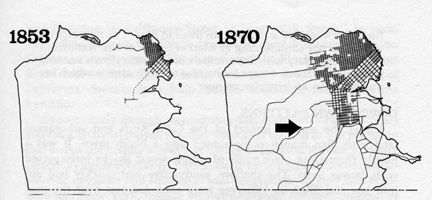
San Francisco was first developed on what is now its most eastern boundary alongside San Francisco Bay. The first owner of the area now known as West of Twin Peaks was Don Jose de Jesus Noe, the last Mexican Alcalde (mayor) of Yerba Buena.
The 4,443 acres of land granted to him in 1846 for Rancho San Miguel were equal to one-sixth of present day San Francisco.
By 1853 and California statehood, Noe had sold his land to John Horner.
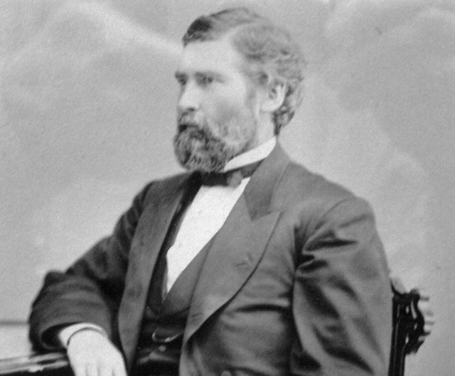
A native of Nottingham, England, George Davidson (1825-1911) came to Philadelphia with his parents when he was seven years old. At the age of 25 in 1850, he headed an expedition to the West for the U.S. Survey. From his new home in San Francisco he was engaged in determining geographic positions from San Diego to the Puget Sound.
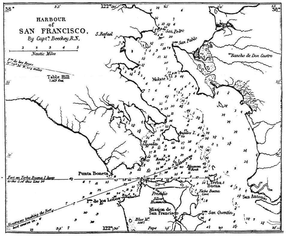
Frederick W. Beechey first mapped Blue Mountain, now known as Mt. Sutro, in 1826. George Davidson’s research and testimony in 1852 exposed as fraudulent a claim by Jose Yves Limantour to all land south of California and west of Divisadero Streets, including all of Rancho San Miguel and Blue Mountain.
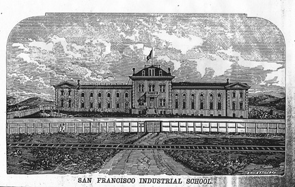
After the take over of California by the United States, Jose Noe sold most of his land to “California’s 1st Farmer,” John M. Horner, for $200,000. San Francisco purchased 100 acres of the rancho for $10,000 from Horner at the intersection of the San Jose and Ocean House Roads for the construction of the San Francisco Industrial School – an institution to deal with neglected, abandoned, and delinquent children under the age of 16 from 1874-1892. The footprint of those 100 acres still exists on today’s maps as Balboa Park and San Francisco City College. (Courtesy Angus MacFarlane.)
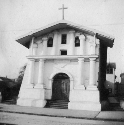
Jose de Jesus Noe died on March 17, 1862, at the age of 57. There is a family burial marker in the floor of Mission Dolores for his wife and two children. Since there is no known headstone for Don Jose Noe, it is not known if he is buried in Mission Dolores with his family. (Courtesy Jeannie MacKenzie.)
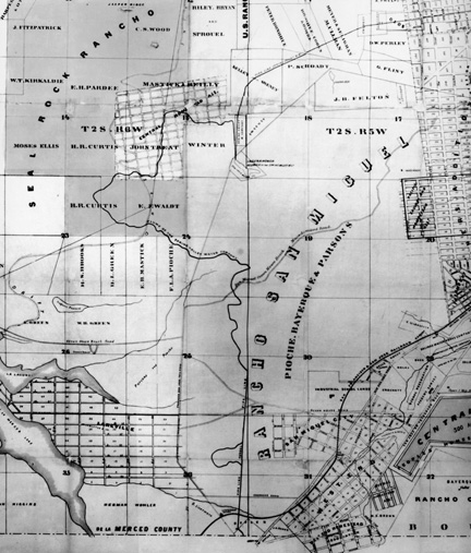
Map of Rancho San Miguel in 1864 showing it is now owned by Pioche, Bayerque, and Parsons and bisected by San Miguel Ocean House Beach Macadamized Road. Parisian born in 1818, suave and cultured Francois Pioche was Secretary to the French Consul in Santiago, Chile, when he decided to join the Gold Rush to San Francisco in 1848 with Julius Bayerque. The map below shows the boundaries of Rancho San Miguel in 1868,
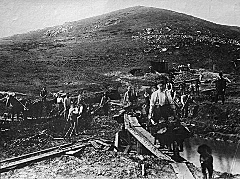
Men at work here in 1891 developing a water supply for the San Francisco from Islais Creek, below what is now Mt. Davidson. It was one of the first water supplies developed by the Spring Valley Water Company. From a small dam west of the old Mission Viaduct near Rock House Gulch in Glen Canyon, Islais Creek water was carried through a flume around the hillside through the Mission to Buchanan and Market. Water to surrounding homes came from wells, however, as the area had ample streams and springs. The earliest recorded hook-up to the Spring Valley Water Company in the area was in 1909 to a house at 663 Mangels Avenue in the Sunnyside District.
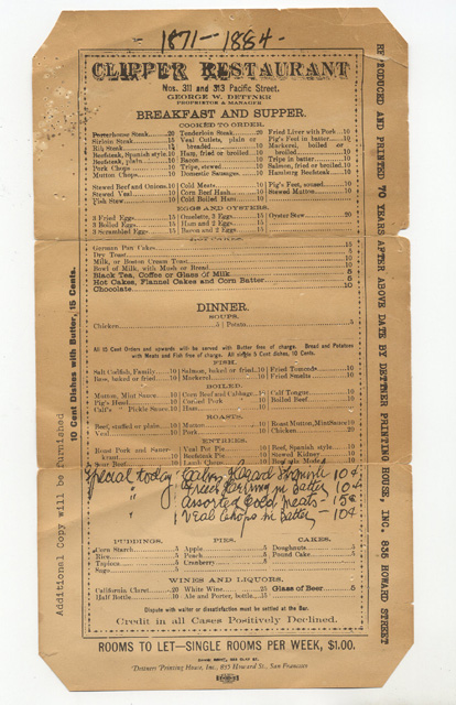
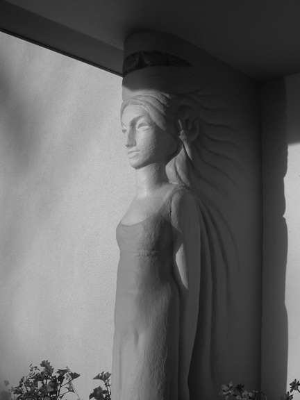
This menu is from the Clipper Restaurant on Pacific Avenue started in 1871 by George Dettner. Born in San Francisco, his parents came from Alsace in the 1830s. He left the restaurant business to start the Dettner Printing House on Howard Street. His son Ernest built a German style home in 1916 from 1906 Earthquake bricks in the corner of Noe’s Rancho San Miguel. Designed by Ida McCain (architect for Westwood Park), it is located at 45 Upper Terrace. At the streets end is where Adolph Sutro marked the exact center of San Francisco with his “Triumph of Light” monument. Granddaughter Elvira Dettner will move west of Twin Peaks to raise her family on Urbano Drive in Ingleside Terraces. (Courtesy Dave Bisho.)
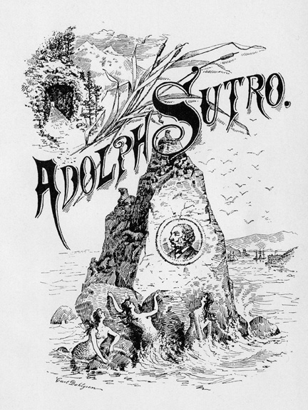
California’s Gold Rush brought Adolph Sutro to San Francisco in 1850 where he became a tobacco merchant. For nearly a decade, his work on a tunnel through the Mount Davidson located above Virginia City, Nevada, to mine the Comstock Silver Lode progressed until completion in the summer of 1878. With his new found riches he bought a fourth of Rancho San Miguel and the land overlooking Seal Rock. (Courtesy Glenn Koch.)
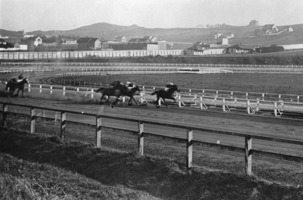
Gambler Edward Corrigan bought 148 acres of Rancho San Miguel to build the Ingleside Race Track. He and his friends were not satisfied with the way things were run at the Bay District Track, and formed the Pacific Coast Jockey Club with A.A. Spreckels, Henry J. Crocker, Joe Ullman, O.B. Donough to build “the most sumptuous racing course in the west,” with a bandstand, stables for 300 horses, a clubhouse – everything a race track needed to compete. It opened on Thanksgiving Day, 1885, to a crowd of 8,000, and operated regularly for 20 years – until December 31, 1905. (Courtesy Margie Whitnah.)
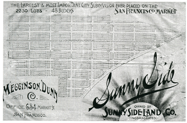
Behrend Joost, “Grand Old Man of Twin Peaks,” bought a portion of Rancho San Miguel from Leland Stanford in 1891. He paved the way to development of Mount Davidson by building the first electric railway over the hills from Market Street to San Mateo through his Sunnyside subdivision. The boundaries he laid were: Melrose Avenue on the north, Havelock on the south, Circular Way on the east and Hamburg Street, now Ridgewood Avenue, on the west. (Courtesy Western Neighborhoods Project.)
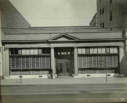
Baldwin and Howell Real Estate Company is established in 1885. One of the oldest established realtors in San Francisco, Josiah R. Howell was the first to be elected president of the San Francisco Real Estate Board in 1905. The company developed Presidio Terrace in 1904 and Jordan Park in 1908. Partner A.S. Baldwin, was the appraiser of Adolph Sutro‘s estate. Sutro’s will stated that his Rancho San Miguel land could not be sold until the last heir died, and that proceeds would go to an educational trust. After Sutro died in 1898, the heirs took his will all the way to the California Supreme Court to get it overturned. From their headquarter office downtown at 318-324 Kearny Street, Baldwin and Howell would proceed to develop Adolph Sutro’s land in Rancho San Miguel into residential housing, beginning in 1912. (Courtesy Westwood Park Association.)
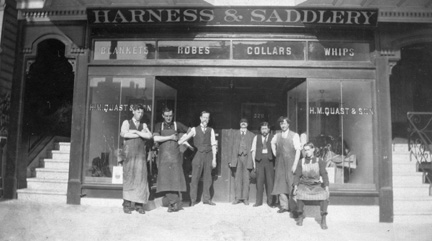
This was the H.M. Quast and Son Harness and Saddlery business located on Sanchez Street between 16th and 17th Streets. Daughter Jeanette Quast will move west of Twin Peaks to raise her family on Mount Davidson in Miraloma Park. Herman M. Quast came to San Francisco from his native Germany around 1870, when San Francisco had the highest percentage of foreign born of any major city in the United States, including New York City. (Courtesy Jeanne Davis MacKenzie.)
Next: Chapter 2 Liveable Neighborhoods